Frisco Surf Report & Forecast
Surf Report, Surf Forecast & Surf Cam
Nearby Spots


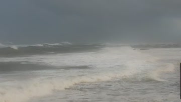
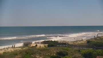
Current Surf Conditions
Condition Rating
Surf Height
2-3FT
Thigh to waist
Swell
Wind
20KTSSSW
26kts gusts, Onshore

Tide
Temperature
76°F

1mm wetsuit

Hatteras Island Forecast
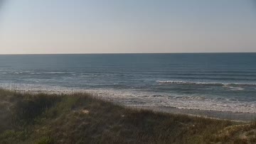
Tim Kent •Today
Weak surf in the shin-knee high range. Cleanest for Rodanthe/PI early with sideshore PM winds.
Dawn-Midday: Minimal surf with a few knee high drifty rights down in Buxton this morning. Most spots struggling to offer any rideable surf on the higher tide early this morning. Conditions are favorable for Rodanthe/Pea Island, it is just pretty close to flat up there.
Afternoon Outlook: More small surf with more southerly texture mid to late afternoon.
WATCH: Tropical Update, El Nino Arrives, and Wknd Forecast
Frisco Surf Forecast
LOTUS Model - our advanced surf forecasting system designed specifically for surfers...
Frisco Surf Guide
The actual pier was named Cape Hatteras Pier, but the actual pier is actually gone. Still, Frisco Pier is the most popular zone on the south side, protected from angry N/NE energy and offshore in northerly winds. Wrap swells sometimes produce grinding lefts, but given Frisco’s south-facing catcher’s mitt and wide swell window, it prefers S swells. Frisco Pier can handle bigger swells but it is aggravatingly fickle, hence the phrase “Frisco Disco.” (Drive all the way down there from wherever you... Read more
Wind data provided by NOAA and its data providers. Liability of any kind arising from use of the data is disclaimed by the providers, including without limitation accuracy, reliability and fitness for a particular purpose.