Raglan Manu Bay Surf Report & Forecast
Surf Report, Surf Forecast & Surf Cam


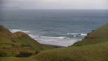
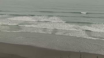
Current Surf Conditions
Condition Rating
Surf Height
2-3FT
Thigh to waist
Swell
Wind
18KTSNE
31kts gusts, Cross-shore

Tide
Temperature
61°F

3/2mm wetsuit

Raglan Points Forecast
Jereme Aubertin •Today
Gusty NE winds are affecting conditions for most areas today. Swell is much smaller on the points.
NE winds are a lot stronger today with bad cross-shore bump and chatter on the points. Swell has dropped to around waist-chest high at best. Open coast areas are dealing with the winds better but it's still very gusty out there as well. Size is bigger in the head high range. Expect similar swell energy and strong NE flow all day.
Raglan Manu Bay Surf Forecast
LOTUS Model - our advanced surf forecasting system designed specifically for surfers...
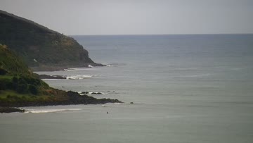
Raglan Manu Bay Surf Guide
Manu Bay is the inside surf zone at Raglan. It's the easiest to access and the most approachable wave, so tends to draw a wide range of surfers. A ledgey, sometimes hollow takeoff zone quickly devolves into a longish rolling left with plenty of room for turns. Read more