Bournemouth Surf Report & Forecast
Surf Report, Surf Forecast & Surf Cam

Nearby Spots

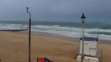
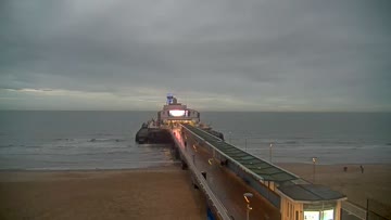
Current Surf Conditions
Condition Rating
Surf Height
1-2FT
Knee to thigh
Swell
Wind
10KTSW
18kts gusts, Cross-shore

Tide
Temperature
59°F

3/2mm wetsuit

Southern England West Forecast
Jamie Bateman •Today
Poor surf, wind-swell builds into the afternoon but nothing special
Dawn-to-Midday: tiny 1ft surf early and fairly light wind. Nothing much worth the effort. Watch for increasing SW wind and choppier conditions by lunchtime.
Afternoon Outlook: short-period wind-swell won't amount to much but there will be junky 2-3ft surf late afternoon/evening. The wind will be easing late so maybe try a sundown paddle on the floatier board if you're keen to get in. Keep expectations low.
Bournemouth Surf Forecast
LOTUS Model - our advanced surf forecasting system designed specifically for surfers...
Bournemouth Surf Guide
The pier helps consistent banks form to the east and west of the structure. They break during the regular windswells, or more rare SW or W groundswell, when the waves can rise above the usual waist high, crowded onshores, to produce some decent, long walls. One of the most popular spots on the south coast with large local community. Read more