T-Street Surf Report & Forecast
Surf Report, Surf Forecast & Surf Cam
Nearby Spots

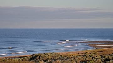

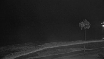
Current Surf Conditions
Condition Rating
Surf Height
8-10FT
2x overhead
Swell
Wind
7KTSWNW
7kts gusts, Onshore

Tide
Temperature
66°F

2mm wetsuit

South Orange County Forecast
Matt Kibby •Today
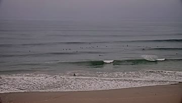
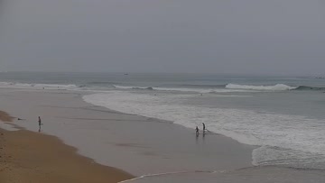
Pumping SSW swell builds all day. Maxes out most beachbreaks, some reefs/points even maxed out.
Dawn-10am: SSW swell builds further. Exposed breaks are easily overhead and well overhead at times. Good spots see waves in the 2x overhead+ range. Powerful with lots of current at open beachbreaks. Generally clean this AM with wind light/variable to light offshore.
Afternoon Outlook: Swell eventually peaks through the afternoon/evening and into Wednesday. Select standout spots likely see sets up to 15' on the face. Low-end moderate SW wind into the PM - some crumble but not bad.
T-Street Surf Forecast
LOTUS Model - our advanced surf forecasting system designed specifically for surfers...
T-Street Surf Guide
T Street is known for one thing -- consistency. The entire West Coast from Jordan River to Cabo could be flat, and T Street, the central hub for San Clemente's finest, would manage to cough up a wave or two that would make a surfer happy. There are a lot of things that help T Street break: sandbars, reefs, rocks and odd seaweed gardens all contribute to the wave's quirky behavior. It'll transform from San O' to mini-Backdoor in the time it takes to do a bottom turn. Although the T Street fanatic... Read more